

1910 Cartago Earthquake: The ruins that shaped Costa Rica’s memory
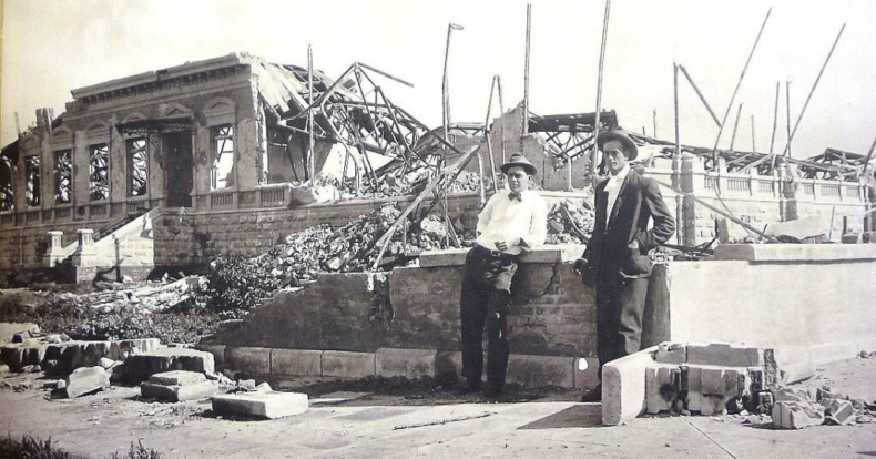

On May 4, 1910, Cartago experienced one of the most devastating events in its history. At 6:50 p.m., a magnitude 6.4 earthquake struck the city and lasted approximately 16 seconds. The intensity of the shaking caused a huge number of buildings to collapse and left nearly 700 people dead.
…the proud old town (of the city of Cartago) is a total ruin instead of being the flourishing city of yesterday. It was totally destroyed!
Amelia and Philip Calvert in A Year of Costa Rican Natural History (1917)
At the time, the city still retained much of its traditional architecture. Adobe and other construction methods widely used during the period offered little resistance to an earthquake of this magnitude. The result was a radical transformation of Cartago’s urban landscape.
A City Struck by Earthquakes
The disaster of May 4 did not occur in isolation. Cartago had already suffered significant damage on April 13 of the same year, when another magnitude 5.8 earthquake particularly affected the city and its surrounding areas.
Weeks later, the May 4 earthquake brought destruction on a much larger scale. The National Seismological Network reports that the maximum intensity in Cartago and its surrounding areas reached VIII on the Modified Mercalli Intensity Scale and that the city was virtually destroyed.
The consequences were particularly severe because many people were inside their homes and other buildings when the earthquake struck. Structures that had been weakened by the previous events were also unable to withstand another major shock. Within seconds, streets, houses, churches, and public buildings were buried under rubble.
The Landscape After the Earthquake
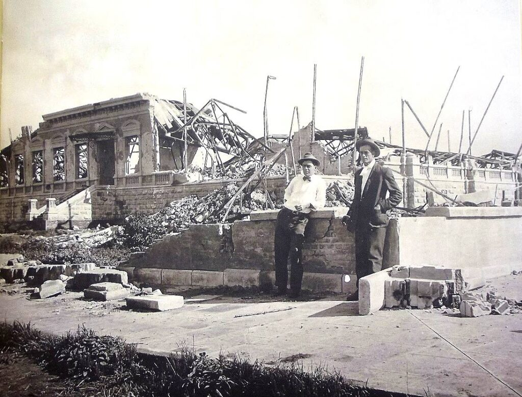
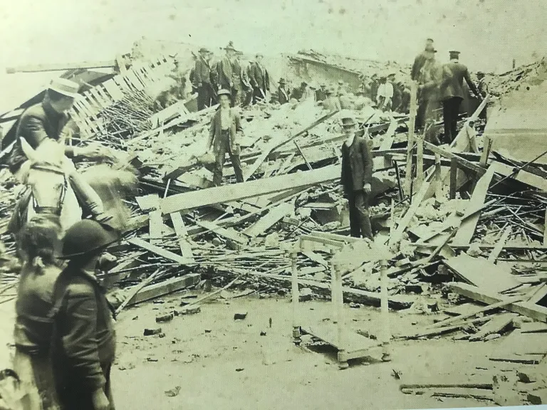
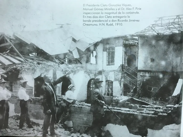
Photographs taken after the disaster reveal a very different Cartago from the city that existed before May 1910. They show collapsed facades, exposed walls, damaged churches, and streets filled with the remains of buildings. The images also illustrate the vulnerability of a city whose architecture relied heavily on materials and construction techniques that could not easily withstand an earthquake of this magnitude.
More than a century later, these photographs have a value that goes beyond simply showing destroyed buildings. They allow us to compare the urban landscape before and after the earthquake and help visually reconstruct a city that had virtually disappeared beneath the rubble.
From Rubble to Reconstruction
The destruction forced authorities and residents to make decisions about how Cartago would be rebuilt. The emergency did not end when the shaking stopped. During the following months, it was necessary to assist those affected, remove debris, restore services, and begin rebuilding a city that had lost a large portion of its buildings.
Municipal records of the earthquake indicate that brigades were organized between May and June and that the first reconstruction measures were put into place. In the following years, public works and measures related to building safety were also developed.
Reconstruction therefore meant much more than simply rebuilding the houses that had collapsed. The earthquake initiated a process of transformation in Cartago and changed the way the safety of buildings was understood.
A Tragedy Also Recorded in Documents
The earthquake generated a large number of testimonies and records. In addition to photographs, historical documents, contemporary publications, and later studies make it possible to reconstruct what happened.
One of the best-known accounts comes from Amelia and Philip Calvert, who visited Costa Rica and later described the condition of Cartago. In A Year of Costa Rican Natural History, published in 1917, they described the old city center as a total ruin.
These testimonies provide insight not only into the physical aspect of the disaster, but also into the impact it had on those who witnessed its aftermath.
Halley’s Comet and the Explanations of the Time
The earthquake also became associated with one of the most remarkable astronomical phenomena of that year: the passage of Halley’s Comet.
During 1910, the appearance of the comet generated widespread discussion and fear among the population. After the earthquake, explanations circulated linking the two events. One belief recorded by the Municipality of Cartago claimed that the comet’s tail had passed through the crater of Irazú Volcano and that this had caused the earthquake.
Today, we know that there was no causal relationship between the two phenomena. Nevertheless, the story is significant because it shows how a society that had just experienced a catastrophe sought explanations for an event that had completely disrupted everyday life.
The fear surrounding the comet and the earthquakes contributed to the atmosphere of uncertainty that characterized those months of 1910.
Photographs as Testimony to a Lost City
Today, images of the earthquake are one of the main ways of getting closer to the Cartago of that time. A photograph may show the facade of a building, a street covered in rubble, or a partially destroyed church. Yet, when several images are viewed together, they make it possible to reconstruct part of the lost urban landscape.
They also show that the destruction did not affect only monumental buildings. Homes and the everyday spaces inhabited by local residents were also part of this transformed landscape. For this reason, photographs from 1910 play a fundamental role in preserving Cartago’s historical memory: they allow us to see the physical consequences of an event that, otherwise, could only be known through written accounts.
More Than a Century Later
The May 4, 1910, earthquake continues to hold an important place in Costa Rica’s history. The National Seismological Network records it as one of the most destructive historical earthquakes in the country, with a magnitude of 6.4 and approximately 700 fatalities.
The ruins, photographs, documents, and testimonies that survived the disaster make it possible to reconstruct different aspects of that night and the months that followed. But the story of the earthquake does not end with destruction. It is also the story of the reconstruction of a city and a society that had to adapt after losing much of its familiar surroundings.
More than a century later, photographs of the devastated Cartago still allow us to understand the scale of the tragedy. At the same time, they remind us that cities are not made solely of buildings: they are also shaped by the memories, testimonies, and experiences of the people who inhabit them.
Sensorial Sunsets
Navigate articles